Mapping Jabal Al-Nathif
(Book + Socially-Engaged Architecture)
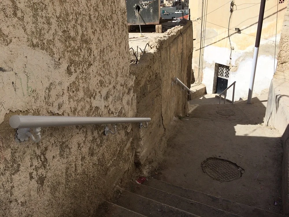
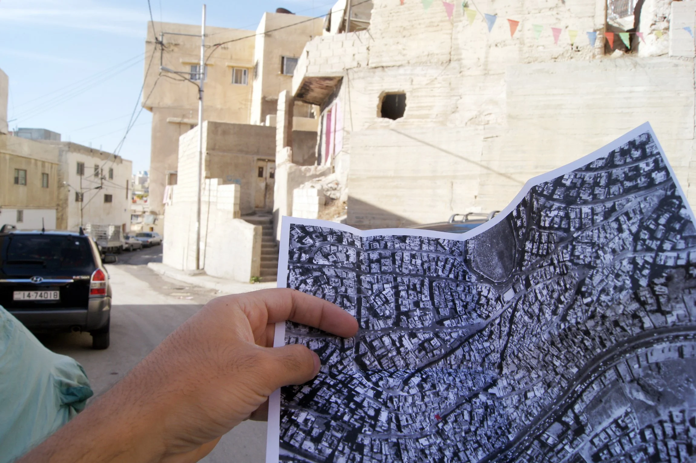
Mapping Jabal Al-Nathif is a spatial mapping of the lived spaces of an unrecognized Palestinian refugee camp in eastern Amman that remains absent from UNRWA maps and governmental maps.
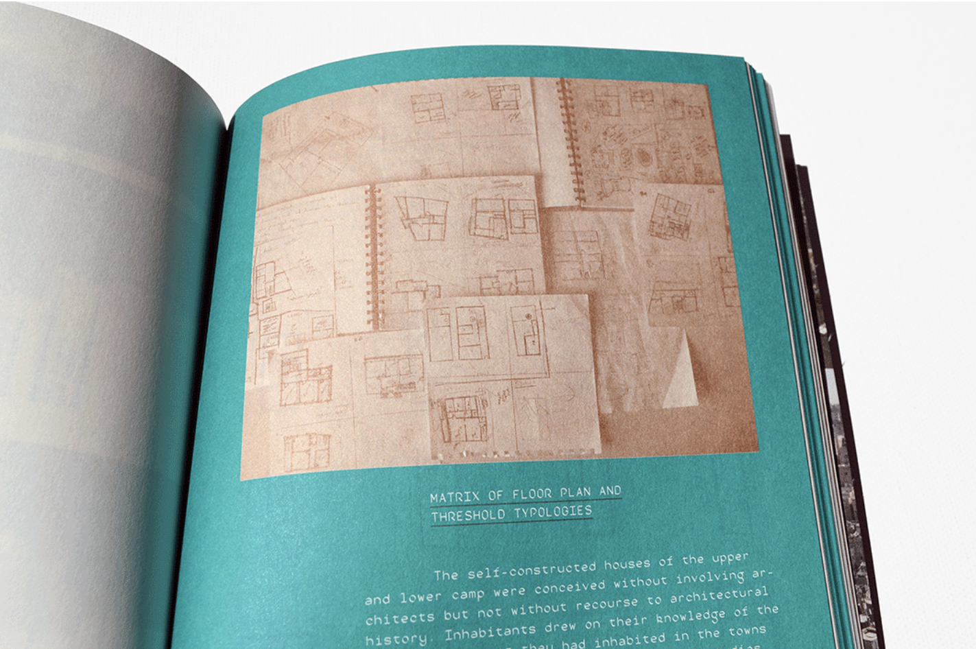
In the first phase of the project, Arini published an open-access book. Mapping Jabal Al-Nathif book records and accounts for the built environment of the Palestinian camp. It relies on an innovative mixed-methods approach to socio-spatial mapping, combining on-site architecture documentation with oral history interviews and ethnographic research. Using architectural drawings, photographs, interview excerpts, surveys, urban maps, and essays, this book records and accounts for the lived space of a Palestinian refugee camp that remains absent from UN maps. full book
The volume includes contributions by Christian Schmidt (ETH Zürich), Siobhan Campbell (Kingston University), Ed Wall (University of Greenwich), Ohoud Kamal (German Jordanian University), and Samar Dudin (Ruwwad Al-Tanmeya). The intensive on-the-ground workshop that led to this publication involved architecture students from the German Jordanian University, the University of Jordan, andand the University of Petra, as well as architects, curators, and anthropologists.
Co-editors: Heba Alnajada (Arini), Mohammad Aljabi (Arini), Liyan Aljabi (Arini), Christoph Lueder (Kingston University), and Alexandru Malaescu (Kingston University).
Following the book's publication, Arini organized a second phase focusing on small-scale urban interventions. We coupled social scenarios with novel design proposals concerned with improving urban life in the camp. These were designed and manufactured in collaboration with local artisans and craftsmen.
Both the book and the small-scale design interventions were funded by the Heinrich Böll Stiftung.